
Potential NKY Streetcar Lines
The general focus of the Potential Lines section is to examine existing rail transit plans for the Tri-State area. In the course of looking at these plans, it came to our attention that planning for streetcar transit in Northern Kentucky has been a somewhat under-examined aspect of these regional plans. To that end, we have developed four possible alternatives for streetcar transit in Northern Kentucky. After analyzing the densities, current transportation routes, past rail alignment designs, current populations for the three river cities of Bellevue, Newport, and Covington, etc., we proposed four other possible routes for the next phase of streetcar development. The four lines are shown in the set of plans below and are analyzed in detail on this page.

Four potential NKY streetcar lines | Image source: Author's
 The Yellow Line | Image source: Author's
The Yellow Line
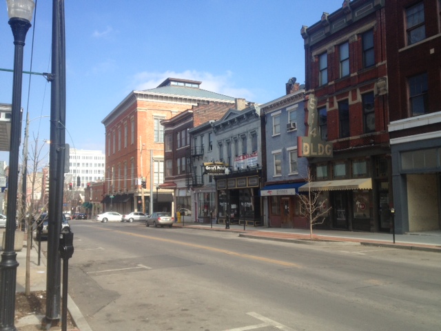
The Yellow Line would primarily serve residents of Covington and Newport, connecting them to the Banks in downtown Cincinnati. The line would connect the three areas via the Southgate Bridge, the Twelfth Street bridge over the Licking River, and the Suspension Bridge. The areas the yellow line serves in Kentucky have a high population density (see the table below) and feature a mixture of uses; both attributes desirable for the development of streetcar transit.
The Yellow Line would primarily serve residents of Covington and Newport, connecting them to the Banks in downtown Cincinnati. The line would connect the three areas via the Southgate Bridge, the Twelfth Street bridge over the Licking River, and the Suspension Bridge. The areas the yellow line serves in Kentucky have a high population density (see the table below) and feature a mixture of uses; both attributes desirable for the development of streetcar transit.

The Yellow Line would connect to many desirable destinations, such as: Newport on the Levee, Great American Ballpark, the Underground Railroad Freedom Center, and the Banks. The mixed-use districts running along Monmouth St. in Newport and Madison Ave. in Covington also offer intriguing spaces to circulate within, with commercial districts and well-preserved, historic architecture. Still, the Yellow Line also provides connections with more dense residential neighborhoods and schools, whereas the other alignment options on this page tend to focus on circulation within commercial districts. Another advantage, enjoyed by all lines in this section, is that the grade for construction is generally less steep in Covington and Newport than it is in downtown Cincinnati; this makes the area more suitable for streetcar development and could save on construction costs.
The Yellow Line would also have high connectivity with TANK's bus service, especially along Monmouth St. in Newport and Madison Ave. in Covington (see plan below). The route also runs along streets that are all lined with sidewalks, an important consideration for streetcar development. |

Image source: Author's
Still, there are some disadvantages to the Yellow Line that should be considered. Interestingly, some of the features of an area that suggest developing a streetcar would be beneficial are related to certain features that make developing this type of transit more difficult. For example: older, more narrow, and urbanized streets, such as Monmouth and Madison, could create difficulties for developing the necessary right-of-way. This route also crosses two bridges: the Suspension Bridge and the Southgate Bridge, which could affect development costs considerably; though the Southgate Bridge was built to economically accommodate rail transit (HDR 2007a). Also, the Yellow Line circulates along a larger perimeter than most of the other prospective lines on this page, increasing the time required to access stops at the opposite end of the loop.


Streets along the Yellow Line | Image sources: Author's
 The Blue Line | Image source: Author's
The Blue Line
The Blue Line is about four and a half miles long and connects Covington and Newport with the Cincinnati streetcar at the Banks. All three of these cities are very dense and are also major centers of employment for the area, which are important factors for the development of rail transit.
The Blue Line also connects many desirable destinations, such as: both stadiums, the Freedom Center, the Smale Riverfront Park, Newport on the Levee, Mainstrasse in Covington, the Northern Kentucky Convention Center, as well as some residential parts of Covington. Part of this route is already serviced by the Southbank Shuttle which runs a route that has been adjusted by TANK over time to better reflect where actual demand for transit is.
Still, the Blue Line has some disadvantages to consider. Unless a double right-of-way was established, with streetcars going both directions (a very costly option), it would take a very long time for someone to get from Newport to Cincinnati or from downtown Cincinnati to Pike Street in Covington. One way to work around this would be to have pull-off tracks at certain points, where a streetcar could pull off to the side to let another streetcar pass. This strategy also requires a fair amount of right-of-way that would need to be acquired and it would be difficult to keep the scheduling running just right for this to be viable. The Blue Line also crosses the Roebling Bridge, which may not be able to support the weight of a modern streetcar. It will also need to cross the 4th Street Bridge, over the Licking River, which would almost certainly need to be reinforced to be able to accommodate a streetcar.
Like the Yellow Line's route, some parts of the Blue Line route are on narrow and built-out streets (for example, Fourth Street in Covington), so it would be difficult to install streetcar track, let alone double tracks. Other streets have more room and have accommodated a horse-car or streetcar in decades past, so it would be relatively easy to install streetcar tracks. The entire Covington part of the route was previously a horsecar and streetcar route.
 The Red Line | Image source: Author's
The Red Line
Like the Yellow and Blue Lines, the Red Line connects Cincinnati, Covington, and Newport. The Red Line is also the longest alignment of the four created, running deep into Covington and Newport along Twelth and 11th Streets and running along the cities' western and eastern edges, respectively. The route connects to Cincinnati via the Clay Wade Bailey Bridge and the Southgate Bridge.
Some key destinations the Red Line is situated along in Cincinnati includes both stadiums, the Freedom Center, and the Banks. The Red Line could also include a transfer with Cincinnati's streetcar system and use the city's presently underutilized Riverfront Transit Center. Some key destinations in Newport and Covington that the Red Line runs along include: the Riverfront Row complex, Newport on the Levee, the York Street Historic District, the Cathedral Basilica of the Assumption, Seminary Square, and Mainstrasse. Like the Yellow Line, the Red Line is also situated along dense neighborhoods and several schools in Kentucky, which are prime areas for streetcar development.
The Red Line faces a conundrum similar to the Yellow and Blue Lines, in that, to be convenient to all of its users, its alignment would ideally have a double right-of-way, with trains running in either direction. Another drawback of the Red Line is its high capital cost due to the sheer length of its loop.
 The Purple Line | Image source: Author's
The Purple Line
The Purple Line primarily serves Bellevue and Dayton, Kentucky, connecting these cities with the riverfront portions of Newport and Covington and the Banks in Cincinnati. Bellevue and Dayton are often overlooked as sites for potential rail transit, as prospective transit plans tend to favor the larger riverfront cities, Newport and Covington. Still, focusing on Bellevue and Dayton may be a viable option, as both have similar densities as Newport and Covington (Bellevue is actually the most dense of the four; see the table below). Also, both Bellevue and Dayton have limited connectivity with arterial roads, as their only main road connection to Cincinnati and the region is Highway 8. This limited connectivity creates traffic congestion during rush hours, which a streetcar could help alleviate to an extent.
The Purple Line primarily serves Bellevue and Dayton, Kentucky, connecting these cities with the riverfront portions of Newport and Covington and the Banks in Cincinnati. Bellevue and Dayton are often overlooked as sites for potential rail transit, as prospective transit plans tend to favor the larger riverfront cities, Newport and Covington. Still, focusing on Bellevue and Dayton may be a viable option, as both have similar densities as Newport and Covington (Bellevue is actually the most dense of the four; see the table below). Also, both Bellevue and Dayton have limited connectivity with arterial roads, as their only main road connection to Cincinnati and the region is Highway 8. This limited connectivity creates traffic congestion during rush hours, which a streetcar could help alleviate to an extent.

Although connecting to Bellevue and Dayton is a good idea, based on existing densities and its present limited connectivity, the Purple Line serves too specific an area to be considered viable without being part of a larger streetcar and light rail network. Moreover, because densities taper off rapidly immediately south of the urban parts of Bellevue and Dayton, and because of the Line's proximity of the river, the Purple Line would likely remain a spur off of a larger streetcar network, with little opportunity to expand beyond its current termination point. Still, the termination point of the purple line in Dayton could potentially connect to a broader, regional light rail network (as is proposed in Cole's Metro Cincinnati plan). Given the paucity of high density urban areas in the Tri-State region, creating intermodal transit options (for example, between streetcar and light rail or between streetcar and bus lines) is one of the keys to making rail transit work for the region. Similar to the other streetcar lines portrayed on this page, the Purple Line would operate best if it had a double right-of-way. Still, given the limited area it serves and the fact that its unlikely to expand, it could be advisable to plan periodic 'bump-outs' to allow streetcars to pass one another.
